
One of the boats headed back to George Town. Spinnaker design colors are the inverse of ours.
Long Island, Bahamas is a long narrow island that runs almost north and south just to the east of the southern tip of the Exumas crossing the Tropic of Cancer. It offers nice protection in it's lea from heavy seas that come into the Exuma Sound and along the south side. Long Island is not heavily populated nor does it have many resorts bringing in lots of tourists and few cruisers go there.

The Tropic of Cancer on Long Island.
We had heard there were amenities for cruisers in Thompson Bay and knew that many cruisers had volunteered time and supplies to help the islanders recover from Hurricane Joaquin a few years ago that severely damaged the islands. Over the week we were there we heard about and saw many projects that the cruiser community had completed for the Island. The Bahamian government did very little to help the island community so the cruisers chipping in really made a significant difference for the residents of the Island.

Looking in to Thompson Bay.
We had heard about some of Thompson Bay's attributes from other cruisers so we decided to make that our stop heading south. Our plan was to spend some time in Thompson Bay, then make the long trip through Comer Channel to the southern end of the island on the way to the Acklins. The waters between the Exumas and Long Island are shallow and follow along the southern end of the Great Bahamas Bank as the deep ocean separates the Bahamas southern islands from the Bank.

Other boats anchored in Thompson Bay when we got there.
When we got to Thompson Bay wind was out of the east with a forecast of it clocking all the way around and building from the north and east so we tried to get up in the northeast corner of the Bay as close-in as we could get. Checking the anchor it was dug in well so we knew we had little concern. Over the next couple days the number of boats in the Bay declined. But then on Tuesday as the wind was gusting out of the south lots of boats came in and by Thursday for the weekend blow there were probably 50 boats in the Bay.
Thompson Bay was reported to have a Cruisers Net, like other places in the Bahamas but we couldn't find it. We were later advised of how to find the net in the morning at 0815 on VHF 18. The net is run by a seasonal resident to promote activities on the island.

Looking toward Salt Pond.
After doing some boat chores on Monday we dinghied in to check out the town of Salt Pond there by Thompson Bay. We rented a car for Wednesday since weather forecast for Tuesday seemed that we probably wouldn't want to leave the boat. When we were in town we met several local people who were very friendly and volunteered lots of information about the goings on around the island. Everyone we talked to was warm and friendly giving us a really good feeling about the island. Later we took the dinghy down to Island Petroleum to fill the tank and scope out the viability of bringing the boat in to top off fuel and water.
For other folks that may visit Long Island, the fuel dock at Salt Pond has been rebuilt and probably well-stocked with fuel and gasoline. There is also a water hose. At the dock the depth is a bit over 5' a mean low water, but it is shallow at both ends so the approach is in the middle and bring the boat alongside. If there is south or west winds it will probably be too rough to go into the dock. The dock is also high adding to the difficulty tying up. Even at high tide our boat was below the dock. While trying to get the boat tied up the dock hand was struggling as I tried to power forward to bring the boat in but the dock hand didn't have control and the bow light went into the top of a piling and broke. I had a spare bulb and lens so was able to jerry-rig a light until I can replace it.
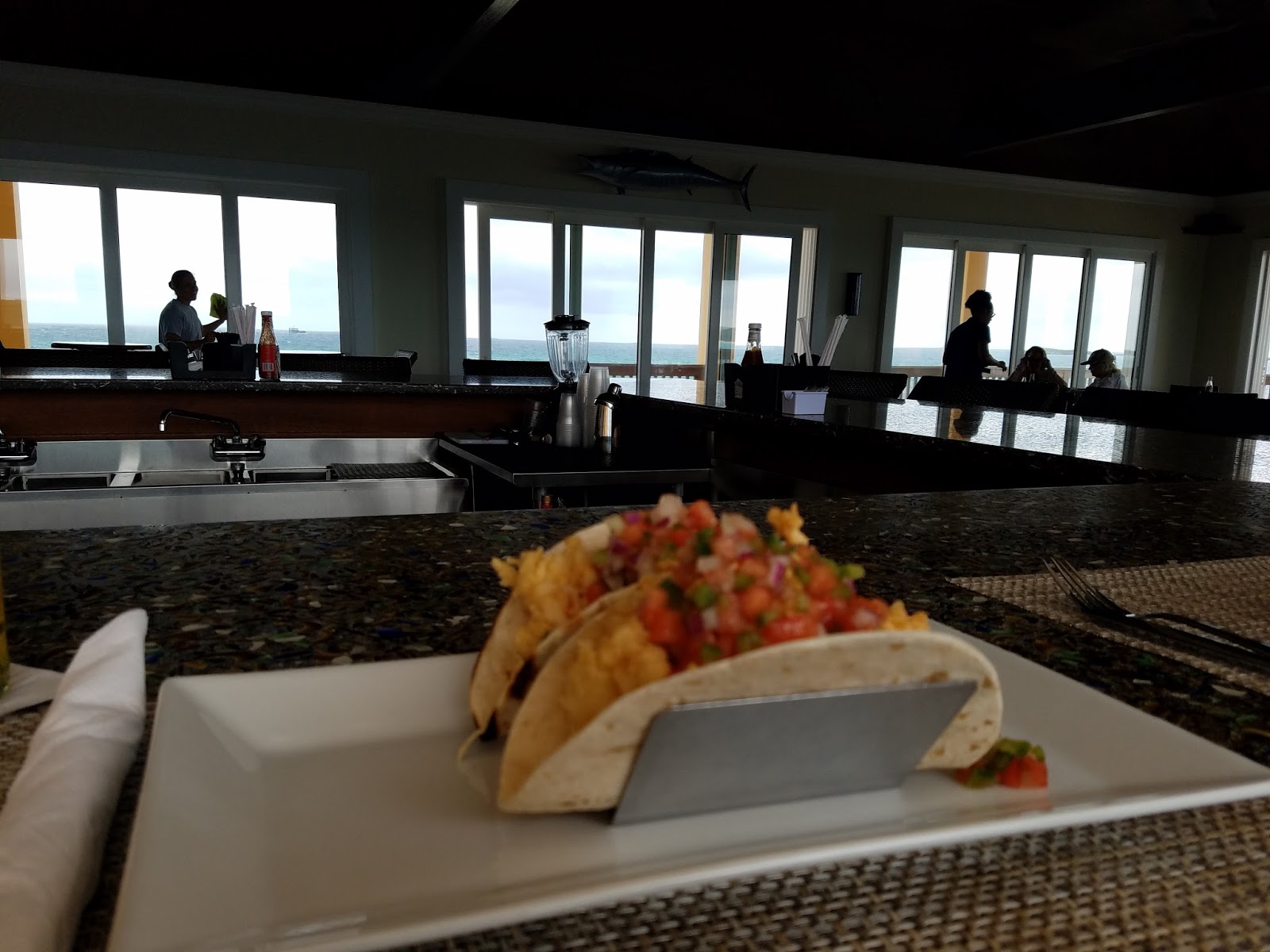
Lobster tacos at Flying Fish Marina.
Tuesday the wind blew from the south and then southwest. As the Bay is open to that direction swell came in making the anchorage rocky. We expected the chop but the forecast was for the wind to keep clocking around and coming down and it actually did so by late in the day the anchorage got much more comfortable. Even at the worst the anchorage was not that bad. Usually in the Bahamas when the wind comes out of the SW it doesn't last long and is not hard to work through.

View of the deck at Flying Fish Marina.
Wednesday we rented our car and drove the island. One of the errands we needed to accomplish was to get some cash. There were 2 banking outlets on the island with ATM's, both many miles away from Salt Pond. We found most of the places on the island didn't accept credit cards so we went through our cash fast. We could have charged our fuel but paid cash instead. We drove south on the island and visited Clarence Town having lunch at the Flying Fish Marina. On the way back up the
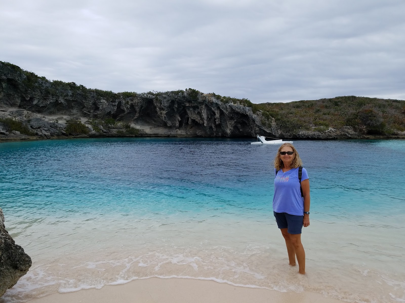
Linda by Dean's Blue Hole.
island we stopped by Dean's Blue Hole which is supposed to be the deepest Blue Hole in the Bahamas. Lots of free divers go there to develop and improve their skills because the depth is over 600'. We drove north to Stella Maris picking up a couple of riders along the way. In the out islands of the Bahamas it is customary to offer rides to people walking along the road.

Stella Maris Marina.
After getting back to Salt Pond we drove out to Tiny's Hurricane Hole, a place we came to know well. But, Wednesday evening we went to Club Washington for dinner with several other cruisers beginning our introduction into the social life at Thompson Bay.
Over the next several days we worked on boat chores and spent time with other cruisers. There was a cruiser happy hour Friday night at the "Sou Side Grill" and Sunday night was a big happy hour at Tiny's. On Thursday we dinghied the laundry over to Tiny's where the only available laundry machines were in Salt Pond and had a pizza and beers while we did the laundry. While there we met several other cruisers and spent hours talking with them.


Tiny's Hurricane Hole.

Cruiser's Happy Hour at the Sou Side Grill on Friday Night.

Cruiser's Happy Hour at Tiny's on Sunday Night.
Saturday was a special day and night. Linda and I planned to walk over to the ocean beach that we had heard about and called our friends Kim and Bryan on Freedom and they invited Linda to go with them to the beach as Kim and her friend Kara on Island Home were headed that way. Bryan and Charlie were heading out to lobster and invited me with them. We spent the afternoon diving several reefs and all we came up with a crab claw. The water was really cloudy because it was rough so visibility was difficult. Afterwards we went by Freedom for drinks and stayed all evening playing a game Cards Against Humanity. What a hoot and a really great time.
We actually planned to leave with the wind on Sunday but we found that our good friends Tom and Sue on Sandcastle were coming in Sunday so we pushed off our departure until Monday and met them along with their buddy boat Kathy and Ron on Stormy Petrol at the Happy Hour on Sunday night. Most cruisers are back on their boats by dark and after that locals show up to enjoy Tiny's. What a wonderful little place with laundry, showers and a nice beach.

Our friends Sand Castle in the light as we prepared to leave.
Having enjoyed life in Thompson Bay for a week it was time to move on. Our course was to head west to Comer Channel then south through the channel and then back east to anchor for the night in Dollar Harbor. The course was about 45 miles but at the end of the day we would only be about 12 miles south of Thompson Bay from where we would depart to the Acklins on Tuesday.
Sailing video of our sailing toward Comer Channel.
We got to Dollar Harbor knowing it would be a challenge because of a shallow bar we had to cross. The area looked totally different from what was on the charts which was not a total surprise considering the hurricane impacts from 2 years ago. We proceeded cautiously with Linda on the bow but we did a soft grounding on the bar that was no more than 4' at high tide. We were able to back off the bar without issue and then began to head further east. I found a tongue of deep water that went in very close to shore so we anchored about 3 miles east of Dollar Harbor (N23.08.890, W75.11.251) in 7-8' of water that was relatively flat and had good holding. On the charts it was marked as unsurveyed but with the exception of a few obvious rocks the entry was very straight forward.


Views of the anchorage. The shallow water and the cays kept down any chop and the wind kept any swell at bay.
During the evening we got some bad news from Linda's sister that their father was not doing very well and that his decline was accelerating. We were now in a difficult position being nowhere close to anywhere that we could securely leave the boat and travel back to the US and Chicago. We had several other considerations that would have to be addressed including slip arrangements in Jamaica and I had a replacement bow light being flown into Inagua. After considerable discussion and research we decided that the next morning we would have to head back to George Town and leave the boat at Emerald Bay and fly back as soon as possible.
The next morning we started back and began to make all the arrangements for our upcoming trip and put our travel on hold. So we left Long Island as we had come and not as we had planned and now some very sad travel days ahead.
No comments:
Post a Comment