
I haven't finished my blog article about our San Blas excursion yet but I wanted to jump ahead and do this one about our trip to the Galapagos while we have good internet to upload the pictures.

Our first view of the Galapos from the bus window as we left the airport. This is Baltra Island with Santa Cruz in the distance.
Like everyone I've heard of the Galapagos since early in school. I've never made a "bucket list" but there are many places I would like to see and the Galapagos was one of those places. My questions and thoughts about the islands exceeded information generally available but I always wanted to see it for myself. Several of our friends have taken their boats their but we don't plan to go through the canal so that was not in our future.
Lying just south of the Equator which passes through the north end of Isabela the largest island.
Our original plan was to sail to Colombia this year with our boat and then do side trips throughout Colombia and South America. But, we would have had to sail back to Panama to stage next year for our further eastward trip to Curacao. So we decided to stay in Panama and travel from there. Also summer is winter in the southern hemisphere so scheduling timing is important. There is also the issue of ever-evolving health protocols with things easing and tightening.


The Quinta La Costanza in the town of Tababela just minutes from the Quito airport.

The Galapagos were discovered in 1535, 13 years after the establishment of Panama when the Bishop of Panama was sailing to Peru and was blown off course. He landed on the islands and noted the geography and descriptions of what he saw. He named them the Islas de los Galopegos. They remained largely unknown until pirates began using and charting them in the end of the 17th century. After that they became the hideout for pirates, source of food for whalers and eventually became inhabited. When South America became independent from Spain the Republic of Ecuador claimed them without any dispute.

Our first Galapagos Critter. A big red iguana colored to camouflage in the dry rocky terrain of Baltra Island.


Scenes from the canal between Baltra and Santa Cruz. The ferry operation was quite a scene. They run constantly as the buses arrive or depart to the air terminal taking passengers across. This is the transit point for nearly everyone entering the Galapagos.
 |
Real fame came to the Galapagos when Charles Darwin visited during the 5 year voyage of the HMS Beagle and he documented the voyage and later published his treatise on the origin of the species from his visit there in 1835. For years after that Ecuadorians began settling on the islands and researchers from all over the world began taking specimens for research. Many groups of settlers came from other parts of the world and the US discussed the idea of establishing a military base to protect the Panama Canal. During World War 2 the US Navy did establish a base on the Island of Baltra, which is now the major airport on the islands, and a base on mainland Ecuador that were used to guard southern approaches to the canal. Some ruins of the base are still visible.

Waiting for the ferry to Isabela

This guy was sleeping on a bench at the Puerto Ayora ferry dock
We left Bocas on 4 July for Panama City. We had some business to do in the City before we left Panama and spent the night because our flight to Quito was early on Tuesday. Tuesday we flew to Quito with plans to fly to the Galapagos Wednesday. Connections would have been too close and we probably wouldn't make it all the way to Isabela so we spent the night in a small town outside Quito near the airport. The new Quito airport is about 30 miles from the city.


Pictures of Santa Cruz Harbor


We stayed in the town of Tababela in a little place called the Quinta La Constanza. When we got there we were overwhelmed by the cold and the thin air along with the beauty of the area. It looked and felt like being in Switzerland. Around the area were high mountains with pine trees. Totally different than the mangrove and palm tree jungles we're accustomed to. We walked around the little town in the afternoon and it was charming. Kind of like a place from a fairy tale. The night was surprisingly cold for us as we left for the airport at 0530 for our 0800 flight. The temperature was in the 40's!


Only 3 commercial airlines currently fly to the Galapagos. Information I read online said there only 2 with 1 flight a day. That may have been true at some point but there are 3 airlines flying there with multiple flights each day. The flight was uneventful. Once we landed they checked our tourist card and we had to pay the Park fee of $100 per person. Then, they scanned our bags again and had a dog check them as well. On our flight 3 bags were pulled and checked for further scanning. After that, we bought tickets for the bus to the channel ferry, then took the channel ferry at $1 per person. Then with a friend we met on the ferry we shared a cab to the ferry dock to go to Isabela. We bought our ferry tickets, had lunch, then paid the dock fee, the water taxi fee to the ferry and then enjoyed the 2 and a quarter hour ride to Isabela Island. We also had our bags scanned before going to Isabela even though they and already been scanned twice that day. Seas were rough and several people got sick.

On arrival in Isabela we paid the water taxi to take us to the dock and then the dock fee so we could leave. The fees weren't a lot in total but it was like a toll booth at each step. We took a cab to our hotel that was right on the main street and not far from the ferry. So our day started about 0400 and we made it to our hotel about 1800 Galapagos time that is an hour behind the mainland. So a total of 14 hours of travel and we landed in our home for the next 5 days.

Isabela is the largest of the Galapagos islands and contains 5 active volcanoes. The government in its wisdom has contained tourism and habitation to the southern part of the island, although I understand tourist boats may go to offshore and shore sites for transient visits.

A flightless Cormorant by the pier in PPUerto Villamil
Habitat destruction is a major concern in the Galapagos. Through hundreds of years of uncontrolled migration invasive species of plants and animals have had a myriad of impacts on the native species that Darwin catalogued and studied hundreds of year ago. Judging from what we saw I think the government may be too little too late. Many of the islands are totally banned from habitation and limited visitation to preserve species. But, there are 25,000 people living in the Galapagos and thousands of tourists arriving each day requiring food and water that aren't naturally present on the island and generate tons of waste. They have limited animals to those legacy on the island but goats, chickens, donkeys, cows and horses all have major impact on the habitat. What the long-term impacts are remain to be seen.


Scenes from our trip to La Cueva de Sucre and Mirador de Mango. The
caves in Galapagos are the result of lava flows where the outside
hardens and the molten lava continues on to the sea.


In the days before phones settlers
used these promontory points for
signaling.
During our stay on Isabela we visited several sites by taxi. We walked to the turtle breeding farm seeing Flamingoes on both trips. We also did a bike ride to the "Wall of Tears" and on the way saw many turtles in the wild. More on these in the pictures description.


After hatching turtles are placed in cages to protect them from predation by rats and birds. Then when they got hard shells they are placed in controlled environments until they are old enough to be released. The turtle hatcheries have repopulated thousands of turtles into the wild successfully. These pictures are from the hatchery on Isabela but the ones at the Darwin Center were very similar.


I've attached more tortoise photos at the end for those that want to see more "in the wild" photos. On two walks we saw many tortoises off eating and enjoying.
Isabela has miles of beautiful beaches that are great for swimming and surfing. Lots of big waves coming on shore. Puerto Villamil is a small town with lots of resort hotels, hotels and hostals. Many of the streets are covered with sand and when we were there a pretty strong onshore wind blew keeping it chilly and lots of waves. Of course it was winter there. We enjoyed the restaurants and happy hours at the Pink Iguana Beach bar that was a favorite of ours and the surfers.


Happy hours at the Pink Iguana
While we were on Isabela we visited the Hospital 3 times to get my dog bite wound checked. They were very nice and helpful. The hospital didn't seem to be too busy as we always got right in and out at no charge. These visits and general care for the wound consumed a lot of time and kept me from diving in some of the most spectacular dive sites in the world. We will have to come back for that.


A group of young Frigate Birds

Some of the many flamingos on Isabela


The last day we were there we did a tour of Isla Tintoreras, a small island just off the town dock, that consisted of an island tour and some snorkeling. It was finally a chance to see the Blue-footed Booby, the Galapagos Penguin and the Galapagos white-tipped reef shark. It was a short trip but great fun.

So on Isabela we saw flamingos, giant tortoises, a flightless cormorant, marine iguanas, Galapagos Penguin and Blue footed boobies. Of course there were many insects and lizards that are also endemic to the Galapagos. After 5 days we took the water ferry back to Santa Cruz. Before getting on to the ferry we had our bags checked again, paid the dock fee and the water taxi fee. The ride back wasn't as rough as the ride over. Once back in Santa Cruz again we paid the water taxi and dock fees with getting our bags scanned.


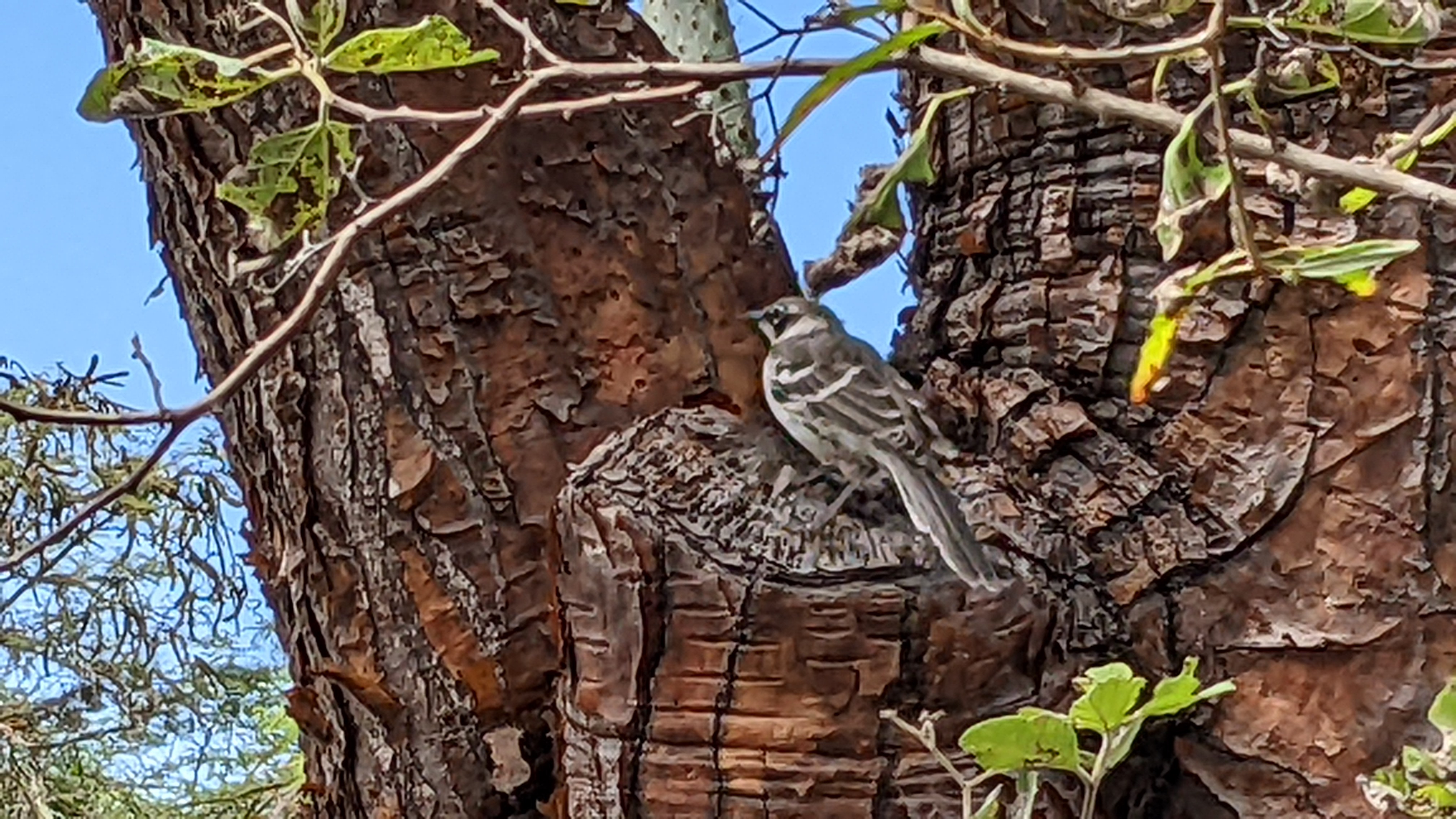
The Galapagos Prickly Pear is dominant throughout the islands and serves a multitude of purposes in the ecosystem. The leaves provided water to sailors, animals, and the stalks provide nesting for finches as an effort to protect their nests from predators.


Santa Cruz is a totally different island that Isabela. The town of Puerto Ayora is the main town in the Galapagos with a population of about 20,000. It includes many residences, resorts, hotels, hostals, stores


Street scenes on Puerto Villamil on Isablea


Hotel Cally where we stayed on Isabela
restaurants and the Charles Darwin Research Center. It also has many ranches and a commercial ship dock on the north end of the island in addition to the passenger docks in Puerto Ayora. Unlike Isabela there was lots of traffic and it even had traffic lights.


We enjoyed many evenings there at a great sushi bar, the Santa Cruz Brewery and the Bahia Mar. The restaurants were generally better than Isabela and more expensive. We spent an afternoon at the Darwin Center that I thought would talk more about Darwin but it was very informative about their work. Another day we did a hike to the Grottoes but since I couldn't get in the water it wasn't as much fun.

We also visited the El Chato Ranch that is also a turtle reserve where we saw many turtles and learned more about the Galapagos environment. Very interesting to learn about the efforts to save the tortoises.

Scientists have documented 16 original Galapagos species of tortoises but there are 11 still in existence. Tortoises were killed for food by pirates and whalers. The turtle breeding centers have tagged all known tortoises with GPS tracking devices and when the turtles mate workers remove the eggs and incubate them. In the wild they are subject to predation and nest destruction from invasive animal species. They


Street scenes from Santa Cruz
then keep them in protected spaces until gradually advancing them as they age until they are finally free to be released in the wild. They have done a great job even though they were unable to save "Lonesome George's" species since he was the last of his species and unable to procreate.

In Puerto Ayora we stayed in an Air BnB that was well located and very comfortable. Spending time there was like any other resort town. Going to, from and in the Galapagos there were many young backpacker types, large cruise groups and a few freelance tourists like us. I can see spending much more time here to get below the level that most tourists see. But, we soon got turtled and iguaned out.
We left Galapagos on 15 July to spend time in Quito and side-trip around the country before heading back to Panama. We enjoyed our trip and hope to return again.

Sleeping owl in a lava tunnel at El Chato Ranch.


Had a nice lunch at the Isla Grill. A very nice place a water taxi ride away from town. When we got back to Santa Cruz from Isabela we were struggling to tell our taxi driver where our Air BnB was. A nice local woman came over and called the host and then instructed the driver how to get there. The woman worked at the hotel that ran the Grill so we thought the least we could do was patronize it. The food was fantastic.


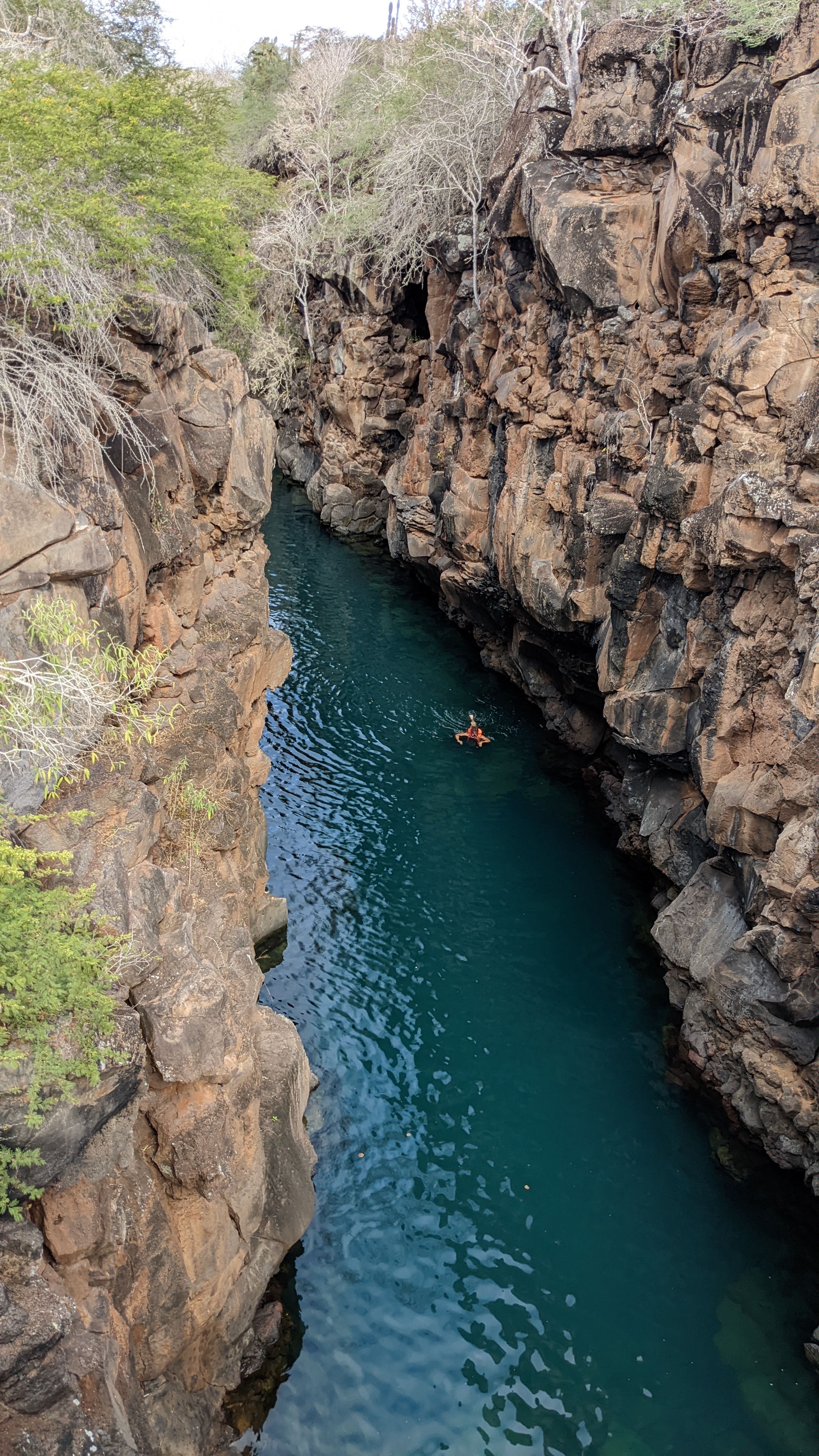
These photos are of the Grottos. We walked there after lunch at the Island Grill and overlooked this narrow seawater passage of deep blue water that was open for swimming and snorkeling with the passage of interesting sea creatures. Also are some views from the top of scenes around the island.


Our last night we weren't really hungry after the big lunch at the Island Grill so we did Happy Hour with some drinks and Octopus Carpaccio at the Bahia Mar. The island is Isla Sant Fe as it peaked in and out of clouds and rain showers.
Turtle porn for those that like to see critters in the wild.


